Hiking mountain Muhabura/Muhavura
Hiking mountain Muhabura/Muhavura: One of the Virunga volcanic mountains is Mount Muhabura, also known as Muhavura in Rwanda and Mount Muhabura in Uganda. Rwanda and Uganda share Mount Muhabura, a dormant volcano that is accessible by foot from both countries. The eight volcanic mountains that make up the Virunga mountain range are dispersed along the boundary between Rwanda, Uganda, and the Democratic Republic of the Congo. Between Lake Edward and Lake Kivu, in the Albertine rift of the East African Rift, are these mountain ranges.
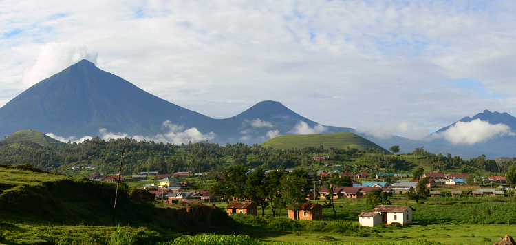
The eight Virunga mountains are: Mount Karisimbi, the highest at 4,507 meters and shared by Rwanda and the Democratic Republic of the Congo; Mount Mikeno, which is only in the DR Congo at 4,437 meters; Mount Muhabura, which is shared by Rwanda and Rwanda at 4,127 meters; Mount Bisoke, which is shared by Rwanda and the DR Congo at 3,711 meters; Mount Sabinyo, which is the only one shared by the three countries at 3,674 meters; Mount Gahinga, which is shared by Rwanda and Uganda at 3,474 meters; Mount Nyiragongo, which is only in the DR Congo at 3,470 meters; and Mount Nyamulagira, which is the lowest but most active.
One of the most popular volcanoes for hiking is Mount Muhabura, which can be reached from the Volcanoes National Park in Rwanda and the Mgahinga Gorilla National Park in Uganda. The Muhabura was given the name Muhabura, which translates to “the guide” in the regional tongue, mostly because it was conspicuous and served as a guide for travelers.
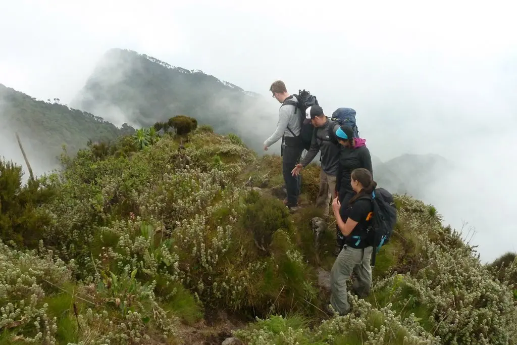
Because of volcanic ash from previous volcanic activity that occurred on the peak some years ago, Mount Muhabura has a cone-like appearance. The mountain slopes have some flora, and as hikers rise and descend, they can observe the differences in vegetation. Hiking Mount Muhabura to the summit of Crater Lake takes one day.
You may encounter forest elephants on your climb up Mount Muhabura, and on a fortunate day, you may even see mountain gorillas. You will also see a variety of birds, so bring binoculars. Although it is only a one-day trip, it is a challenging one to complete, therefore one must be both physically and mentally prepared because you must climb and descend before nightfall.
Ranger escorts from the Uganda Wildlife Authority will accompany hikers who choose to ascend Mount Muhabura from the Ugandan side, and the briefing will take place at the Ntebeko visitor center. The Rwanda Development Board has trained and deployed ranger guides to lead hikers who choose to undertake this activity from the Rwandan side. The briefing will take place at the Kinigi visitor center. Before you begin the climb, you can also rent the necessary equipment here, such as porters or walking sticks.
Ranger guides will be allocated to trekkers based on their groupings, and they will lead the way while sharing information about the climb and the region. Porters will assist hikers who may have additional luggage, and if there are a lot of hikers on a given day, the group will be split into two groups, usually the fast hikers and the slower hikers, so that everyone is taken care of.
The park rangers begin the Mount Muhabura walk at around 7 am, and it takes them 5 to 7 hours to finish the ascent and descent. You learn about the history of Mount Muhabura, its formation, and its most recent eruption throughout this journey up the mountain.
To ensure a smooth and effective trek, you should bring long pants, long-sleeved shirts that will shield your skin from irritations while you navigate the bush, and a good set of hiking boots. The cost of a trek permit to Mount Muhabura is $75 USD per person. Reach out to us and let us to plan your Mount Muhabura hike.
Uganda is known as the “pearl of Africa” because it is the most beautiful country in East Africa. It boasts stunning scenery and a large number of hills.
An extinct volcano in the Virunga Mountains on the Rwanda-Uganda border, Muhabura-The Guide (Kinyarwanda in the local tongue) is partially located in Rwanda’s Volcanoes National Park and partially in Uganda’s Mgahinga Gorilla National Park.
Climbers, do not be alarmed! In Kisoro district, there is a mountain that is convenient to drive to and a good place to go hiking. At about 4,127 meters, Mount Muhabura is the third-tallest mountain in the nation. Muhabura offers hikers a strenuous climb with its own benefits, such as breathtaking vistas of the surrounding landscape and fauna, such as buffalos, primates, and birds. Independent treks are also an option, though most visitors walk the mountain following a gorilla tour in Mgahinga National Park.
How to Get to the Hiking Mountain Muhavura/Muhabura
The trip from Kampala to Kisoro, the location of this mountain, takes roughly eight hours. You have the option of using public transportation or renting a car.
When You Get There
Soon after you arrive, guides from the Uganda Wildlife Authority will spot you and rush to you. When you ask for assistance, you will be led to the tourist center. You will receive a guide to help you reach the summit of Mount Muhabura after paying for the activity. If you have a backpack, you can ask for a porter to assist you with carrying your bags. Savor the breathtaking vistas of Rwanda, Uganda, and the Democratic Republic of the Congo. The hike is somewhat strenuous and somewhat steep.
In the native dialect, Kinyarwanda, the word Muhabura means sentinel.Usually, the hike takes a full day. The current park costs for the climb, which include the park guide, are $75 USD per person. Visitors must drive or be taken to the volcano’s base from the park headquarters in Kinigi, where the hike starts at around seven in the morning.
Although Mount Muhabura may not be as glitzy as other well-known tourist destinations, it does provide outdoor enthusiasts with an enjoyable day trip that is close to Kisoro and, best of all, quite affordable. For these reasons, you should think about hiking Mount Muhabura.